/131.3903704,33.282333,9/397x132?access_token=pk.eyJ1IjoiamFwYW50cmF2ZWxtYXBzIiwiYSI6ImNqbXBtOXYxbDB5Z3ozbHFrazJuYWMwOGYifQ.v15fy_mcFWtgopmz8PhwqA)

Activités
Climbing Mount Yufu, Kyushu
Nicole BauerWhen the trail is getting a little steeper and a bit rocky, you will have almost reached the saddle between the two peaks. Now there is a choice to make.
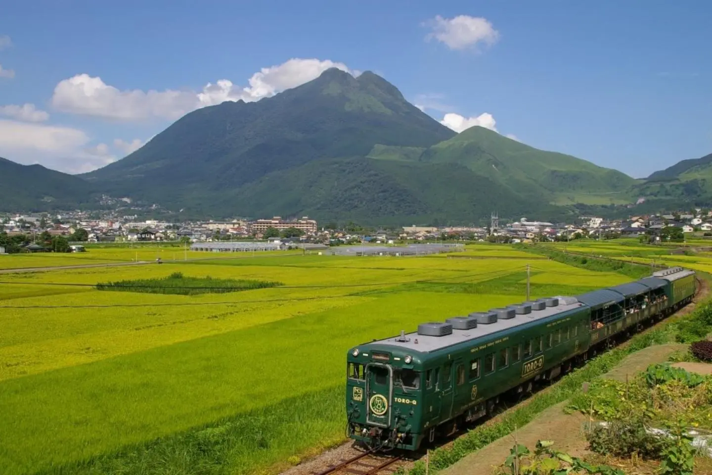
Mount Yufu is a stratovolcano located on the border of Yufu and Beppu in Oita Prefecture, Kyushu. The summit reaches a height of 1,583.3 meters (5,195 feet) and there are two peaks, both popular for hiking; Higashi-mine Peak in the east and Nishi-mine Peak in the west with the latter being one meter taller.
The two peaks resemble the humps of a camel overlooking Yufuin City. The paths are clearly marked and it makes for an easy to intermediate hike. It takes about two hours to reach either peak and an hour and a half to descend. Many hikers elect to visit both peaks in one day. There are also sites at the base of the mountain that hand out free trail guides to would-be hikers. Higashi-mine is the easier of the peaks to climb, while there is a level of difficulty in reaching the peak of Nishi-mine and is advised for more experienced hikers. From the saddle between both peaks, it is a fifteen-minute hike to either peak.
Autumn seems to be the high-season for hikers to visit and admire the many-colored leaves along the trails as well as the sweeping vista from the summit.
A 20-minute drive from Yufuin City to the base site: Yufu-tozan-guchi (由布登山口, 896 m).
When the trail is getting a little steeper and a bit rocky, you will have almost reached the saddle between the two peaks. Now there is a choice to make.

Mt Yufu, the dual-peaked mountain that looms over Yufu City, makes for an excellent day hike in the warmer months,
เขายูฟุ เขาที่มียอดแหลมสองยอดปรากฎเป็นภาพอยู่เหนือเมืองยูฟุ เป็นเส้นทางเดินเขาที่เยี่ยมยอดเส้นหนึ่งในเดือนที่อบอุ่น
Núi Yufu, hai đỉnh núi kép lờ mờ trên thành phố Yufu, làm cho một ngày leo núi tuyệt vời trong những tháng ấm áp

Experience a diverse range of landscapes when hiking up the captivating peak of Yufu-dake
Вдохновитель разнообразными ландшафтами, взбираясь на захватывающий пик горы Юфудакэ
Trải nghiệm một loạt phong cảnh đa dạng trong chuyến leo lên đỉnh núi cao quyến rũ Yufu-dake đầy hấp dẫn.
Wenn der Weg etwas steiler und felsiger wird, haben Sie die Anhöhe zwischen den beiden Gipfeln fast erreicht. Jetzt gilt es, eine Wahl zu treffen.
Когда тропа становится круче и каменистее, развилка между двух пиков уже близка. Теперь нужно выбрать, на какой пик подниматься.
Saat jalur pendaki lebih curam dan berbatu, Anda hampir mencapai titik tengah antara dua puncak tersebut. Di sinilah Anda harus menentukan pilihan Anda.

Le lac Kinrin est situé à Yufuin Onsen dans la préfecture d’Oita, et le nom Kinrin signifie "Écaille de poisson d’or". La source de ce nom vient des poissons vivant dans le lac dont les écailles apparaissent comme des étincelles dorées quand le soleil se couche. Le lac est célèbre pour sa brume matinale qui se crée lorsque son eau de sources chaudes et froides se mélange. Il y a quelques sentiers de randonnée autour du lac à partir desquels vous pourrez profiter de superbes vues sur la région avec une flore et une faune distinctive. Il y a de nombreux onsen, restaurants et cafés sur les rives du lac. Vous trouverez aussi quelques musées d'art dans la région, dont beaucoup exposent des œuvres d'artistes ayant des liens particuliers avec Yufuin.

Umi Jigoku ("l'enfer de la mer") est l'un des sept "enfers" de Beppu, des attractions thermales connues pour leur apparence naturelle unique. Ces onsen très particuliers possèdent chacun des bienfaits spécifiques, mais on ne peut pas s'y baigner puisque leur température dépasse souvent allègrement les 100°C. Umi Jigoku et son bassin principal dont l'eau bleus turquoise fumante qui donne presque envie d'y plonger, ainsi que son étang rempli de solides nénuphars géants pouvant supporter un poids jusqu'à 20 kilos, font de cet onsen le plus connu des enfers de Beppu. Ne manquez pas les autres enfers de Beppu plus fascinants les uns que les autres et profitez-en également pour tester la cuisine "Jigoku Mushi" préparée à l'aide des vapeurs des sources chaudes!
