La Route Alpine Tateyama Kurobe
Yunxuan KohDécouvrez les sites phares de la route alpine Tateyama Kurobe !

Opened in 1971, the Tateyama Kurobe Alpine Route is a mountain sightseeing road that connects Toyama and Nagano Prefectures. Despite being only 37 kilometers (23 miles) long, the route has several scenic stops along the way as well as hiking trails. From the top of the mountain, it’s even possible to see Mount Fuji on a fine day.
Hours of access change each season, please check their homepage for current hours of operation.
There are five different ways to traverse the alpine route, by funicular, bus, trolley, aerial tramways, and walking. It is important that no private transportation uses the route so that exhaust fumes do not harm the snow tunnels. During summer, shuttle buses also run between Toyama and Murodo.
Closed annually from December to mid-April for its deep and inaccessible snows, the main attraction of the Tateyama Kurobe Alpine Route is the scenery provided by the Tateyama Mountain Range, which is part of the Chubu Sangaku National Park. From mid-April to late June the snow corridor, a snow wall that reaches 15 to 20 meters high, becomes a visitor-favorite vista.
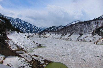
The rest of the year, the route remains a beautiful spot to see autumn leaves via the various hiking trails. And even offers a pathway to visit Kurobe Dam, which discharges water between late June and mid-October.
Transportation departs from Ogizawa or Tateyama stations.

Découvrez les sites phares de la route alpine Tateyama Kurobe !

Kurobe Dam is Japan’s tallest dam at 186 meters high and 492 meters long. It’s located in Toyama Prefecture and supports a hydropower plant. Built between 1956 and 1963, the dam was a massive engineering feat at the time and cost 51.3 billion yen (142.5 million USD) to complete. Although many issues arose during construction, the dam now helps supply the Kansai region with electricity. Featured in many kaiju (monster) movies in the past, Kurobe Dam is also a popular tourist spot and the most popular hydropower site in Japan. Between late June to mid-October, the spillway is opened at various times during the day for nearby onlookers to witness. The dam spits forth more than 10 tonnes of water every second. Crossing the dam takes about 15 minutes by foot—however, those who make the trek are rewarded with various vistas of the dam and Kurobe Lake. Visit the eastern end of the dam and walk up the stairs there (220 steps and quite steep) to arrive at the observation deck and see some of the best angles of the dam.